
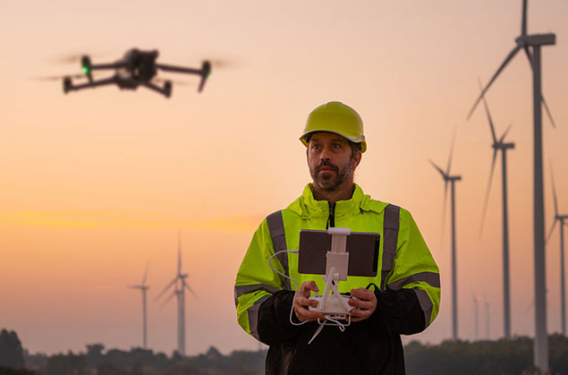
If you manage a construction site, you have likely wondered how to keep track of everything without being on-site every day. You need a clear way to see progress, safety concerns, and layout changes without slowing down your schedule. This is where drones fit naturally into construction monitoring.
Construction teams use drones to capture clear overhead photos, videos, and maps that show site progress, quantities, and potential risks. A basic monitoring setup usually includes:
- Weekly or biweekly flights from the same angles.
- Progress photos and short videos for updates.
- Measurable maps for tracking earthwork and materials.
- Visual checks of roofs, edges, roads, and work zones.
- A shared folder or dashboard for the full team.
Below, you will learn what site monitoring really means, what drone deliverables look like, how flights are planned, and the safety rules that matter.
What construction site monitoring really means
Monitoring a jobsite means having clear visibility so decisions happen faster and with better information. Drones help by capturing the entire site in one flight, including areas that are hard to see from the ground.
Most teams use drone monitoring for progress updates, measurements, and risk awareness. When flights repeat from the same height and location, it becomes easy to compare changes week after week.
Info: If you plan to hire a drone pilot for business use, they must hold an FAA Remote Pilot Certificate under Part 107. This certification confirms they can legally fly for commercial work.
The main ways drones help on a jobsite
1) Progress tracking that is easy to follow
Overhead photos make progress updates clear for owners, lenders, and remote teams. One image set can show framing, roofing, paving, staging areas, and traffic flow.
A typical progress package includes:
- 10 to 25 labeled photos from fixed angles
- A short overview video for the site context
- Notes that match the project schedule or pay application
2) Clear documentation for RFIs and change orders
Drone photos create time-stamped records of site conditions. This helps answer questions about what existed before a change or how an area looked at a specific point in time.
Fact: OSHA construction guidance shows that many hazards exist on active sites, including falls, equipment movement, and electrical risks. Clear visual records help teams plan and communicate more safely.
3) Measurements and quantities that save time
Drone mapping often produces an orthomosaic, which is a large image that allows on-screen measurements. Some projects also include surface models to track the Earth’s movement.
Teams commonly measure:
- Stockpile volumes like soil or gravel
- Cut and fill changes over time
- Access road widths and material zones
- Work area size by project phase
4) Safer checks of difficult areas
Drones allow visual checks of roofs, facades, and elevated areas without sending someone up just for a quick look. This helps decide where hands-on inspection is truly needed.
Warning: Drone footage supports safety planning, but it does not replace inspections, safety programs, or required site roles. Use visuals to guide action, not replace responsibility.
A simple monitoring plan you can use
Consistency matters more than editing or special effects. A repeatable routine makes images reliable and useful.
| Monitoring Need | What to Capture | How Often | Who Uses It |
| Progress updates | Same-angle photos and overview video | Weekly | PM, owner, stakeholders |
| Earthwork tracking | Maps and volume measurements | Every 1 to 2 weeks | Superintendent, estimator |
| Safety awareness | Risk zones, access routes, edges | Weekly or after changes | Safety lead, foreman |
| Dispute support | Time-stamped key area photos | As needed | PM, owner, legal |
Quick Tip: Choose 6 to 10 anchor shots and keep them identical every flight. Changes stand out instantly when the angle stays the same.
What happens during a typical drone flight
Construction sites are active and unpredictable, so professional drone operators follow a clear checklist.
A normal flight includes:
- Confirming goals for progress, mapping, or issue review
- Checking airspace rules and requesting authorization if required
- Walking the site to find hazards and safe takeoff areas
- Flying planned paths and capturing agreed shots
- Labeling files and delivering them through a shared link
Suggestion: Ask for a one-page flight plan before the first visit. It should list deliverables, shot angles, frequency, and who receives the files.
Data, privacy, and file handling basics
Drone images may capture vehicles, nearby properties, and sensitive layouts. Treat the data like any other project document.
Good habits include:
- Sharing files only with approved team members
- Using clear folder names and dates
- Removing outdated files to avoid confusion
- Keeping secure systems between field and office teams
Conclusion
Construction site monitoring works best when it stays consistent. Repeat the same shots, deliver clear progress packages, and use maps when measurements matter. This approach reduces surprises and keeps everyone informed.
If you want a dependable monitoring routine for your project, Advanced Aerial Intelligence Solutions provides construction site drone support with clear deliverables, reliable schedules, and organized results.
Frequently Asked Questions
How often should a jobsite use drone monitoring?
Many teams begin with weekly flights and later move to biweekly once reporting feels stable.
Do I need permission to fly near an airport?
Controlled airspace often requires authorization, and LAANC supports near-real-time approvals in many areas.
Can drone photos support pay applications or owner updates?
Yes. Consistent angles and labeled images make progress easier to review and verify.
Will drone monitoring replace site walks?
It supports better decisions between visits, but most teams still rely on regular site walks for close detail checks.